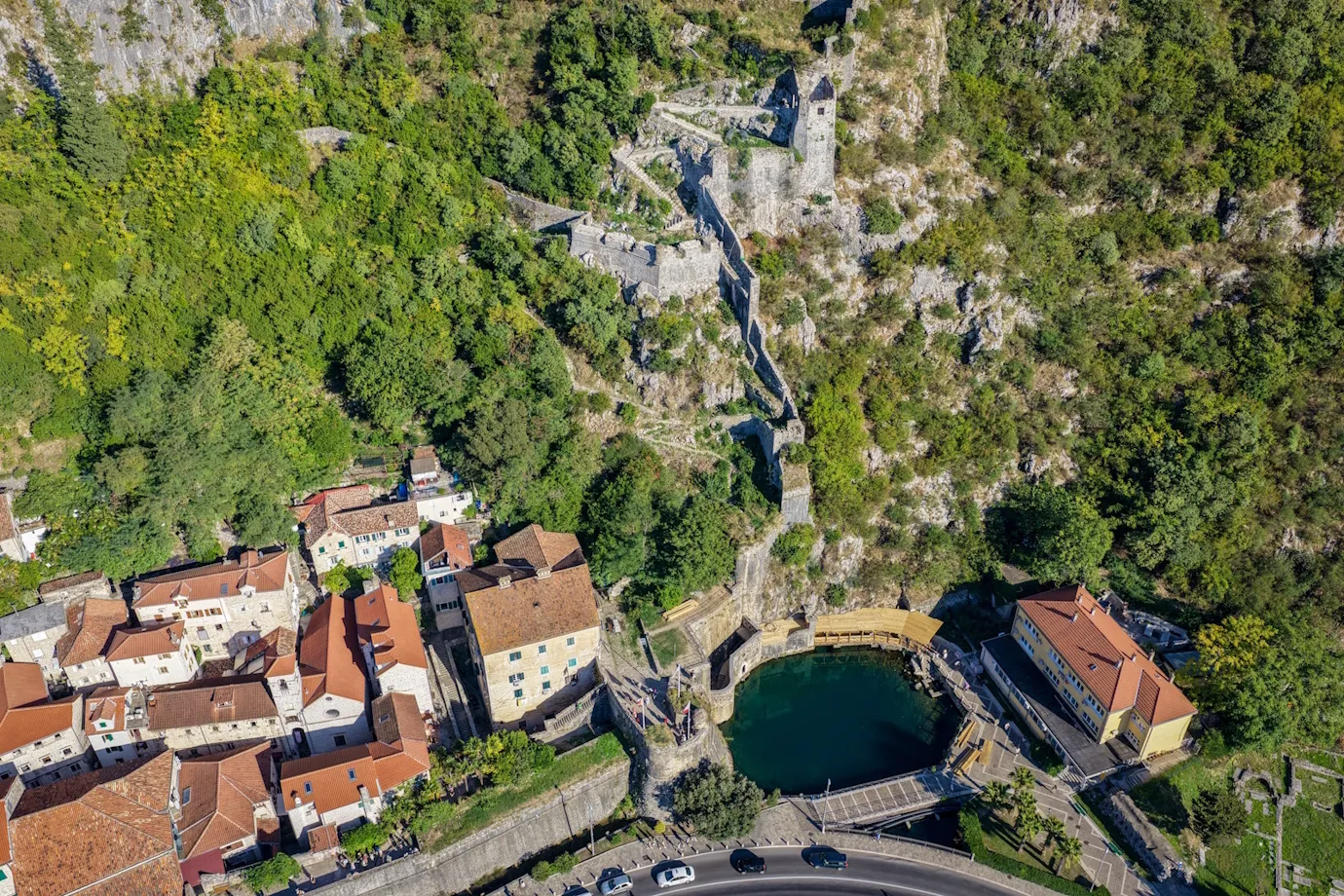
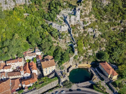
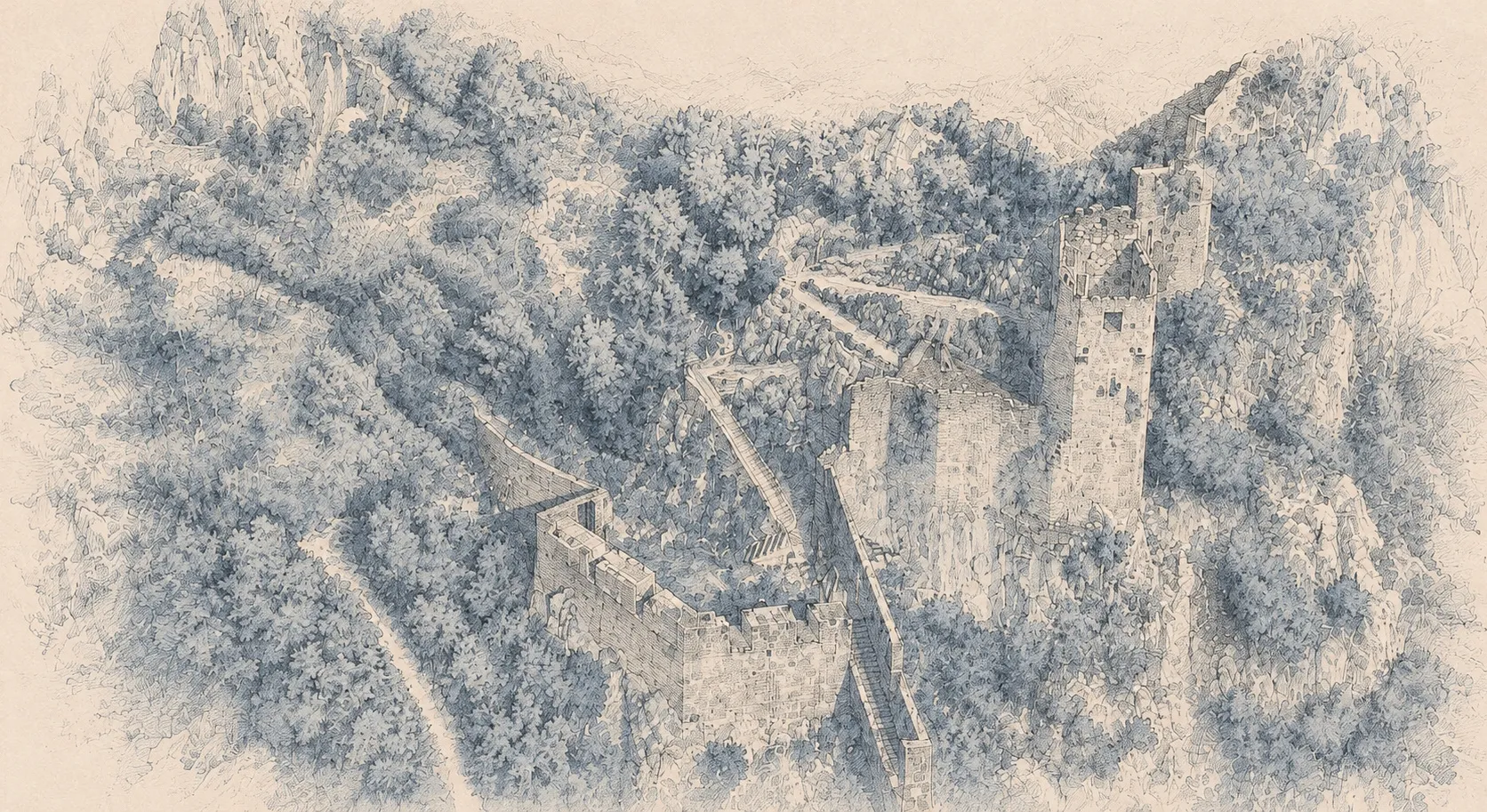
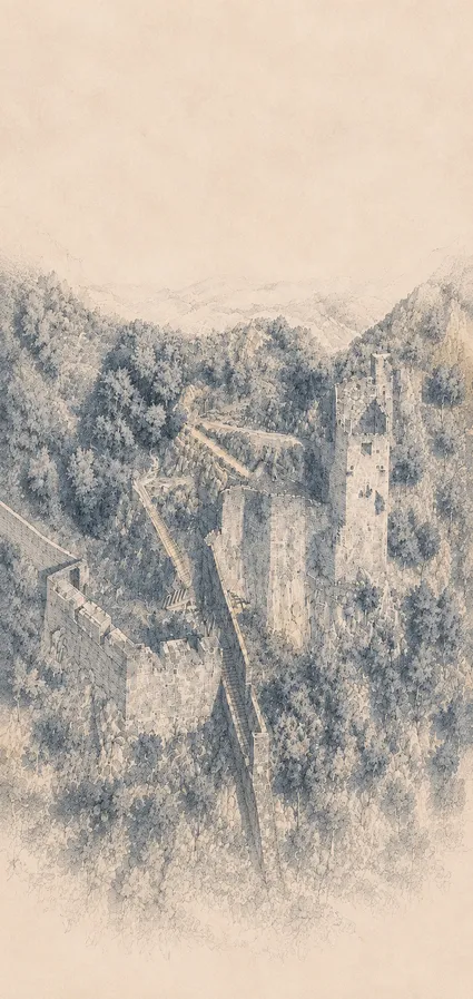
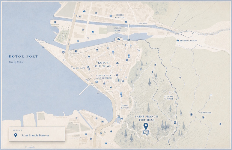
The Saint Francis Position is stylistically and chronologically dated to the mid-sixteenth century. It represents an authentic example of a modern artillery platform, or fortification point alla moderna, designed to control the southern sector of the Kotor Fortress near the Gurdić Gate. From this strategically important location, the defenders could respond to attacks approaching from both land and sea. Its architectural characteristics correspond to those of the Bembo and Riva bastions, placing it among the most important Venetian military works of the period.
1539
Barbarossa's Attack on Kotor
The Ottoman attack led by Hayreddin Barbarossa marked a turning point in the development of Kotor's fortifications. During this period Venice modernised the city's medieval walls by constructing new artillery bastions capable of resisting firearms. The Bembo and Riva bastions, built at the time of Barbarossa's campaign, share the same architectural characteristics as the Saint Francis Position and provide an important reference for dating its construction.
1584
First Historical Illustration
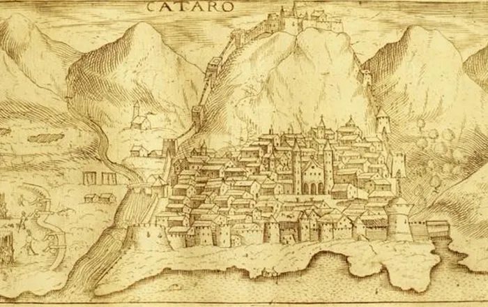
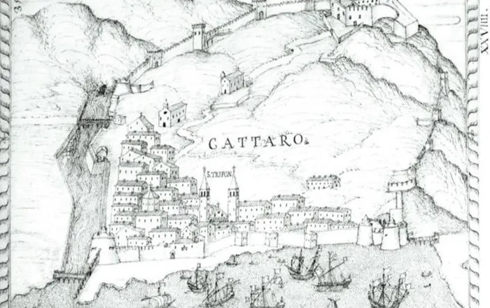
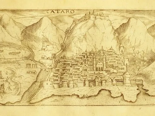
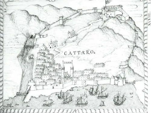
The earliest known depiction of the Saint Francis Position appears in Angelo degli Oddi's 1584 view of Kotor. Published in his work on the maritime provinces, the illustration records the southern fortifications together with stairways, communication routes and artillery positions on the hill of Saint John. Although simplified, it represents the first reliable historical image confirming the existence of the Saint Francis Position within the defensive system of Kotor.
1657
Demolition of the Saint Francis Monastery
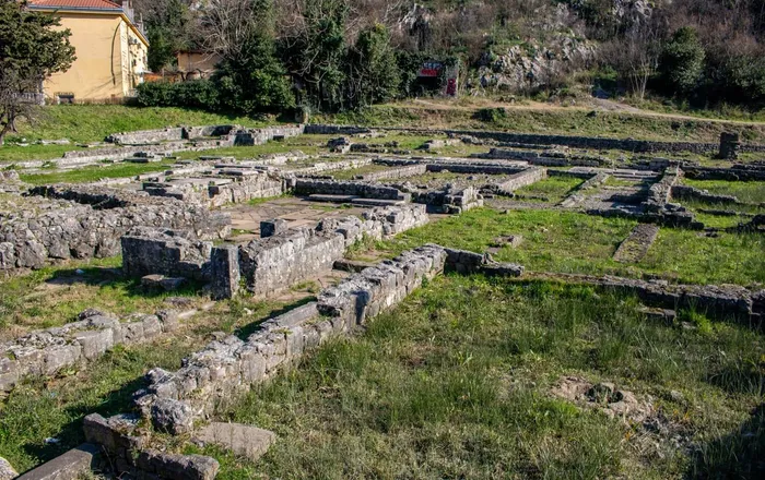
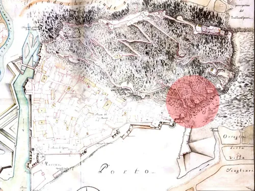
During the Ottoman siege of Kotor in 1657, the Venetian authorities demolished the Saint Francis Monastery and Church outside the Gurdić Gate to prevent enemy forces from occupying the complex. Although the monastery disappeared, its name remained permanently associated with the nearby artillery position. Today, the Campo Santo archaeological site marks the location where the monastery once stood.
1667
Earthquake and Reconstruction
The devastating earthquake of 1667 caused extensive damage throughout Kotor, including sections of its defensive walls and military structures. Significant repairs and reconstruction followed in order to restore the fortress to full defensive capability. The disaster marked one of the most demanding periods in the history of maintaining the fortification system.
1747
The Saint Francis Powder Magazine
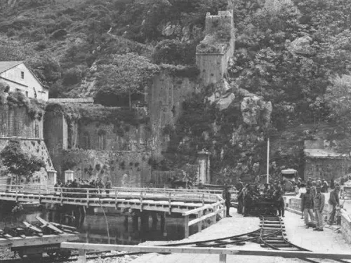
By the eighteenth century, the Saint Francis complex had developed into an integrated military zone connected by fortified communication routes. Historical documentation records the New Saint Francis Powder Magazine together with access routes protected by massive retaining walls, parapets and loopholes. These structures formed an essential part of the southern defensive sector and supplied the nearby artillery positions.
1768
Filseck's Plan
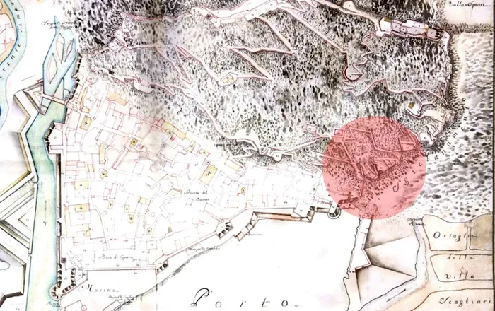
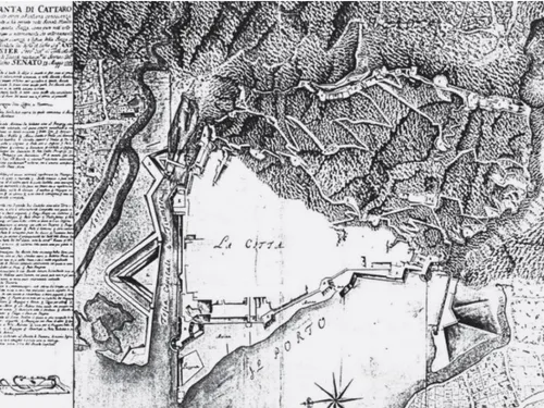
Moser de Filseck's military plan of 1768 provides the most detailed historical record of the Saint Francis Position. It identifies the Lower and Middle Saint Francis Lunettes, the guardhouse, the Upper Lunette, the Zen position and the powder magazine. The plan documents the organisation of the entire defensive complex and reflects the final major Venetian reconstruction of the Kotor Fortress.
1918
End of Military Function
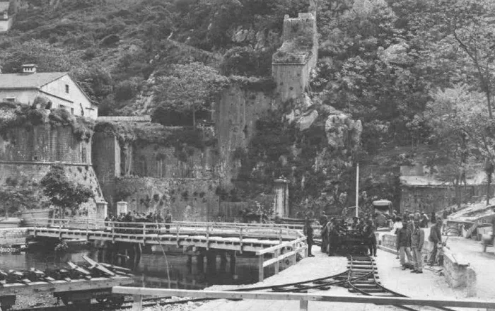
The last military works on the fortress were carried out during the First World War. Following its end in 1918, the centuries-old border between the Bay of Kotor and Montenegro disappeared, and the fortress lost its strategic military importance. Without a permanent function, many of its structures gradually fell into decay.
1979
A New Phase of Preservation
The 1979 Montenegro earthquake caused severe damage to Kotor and its historic fortifications. In the years that followed, systematic documentation, conservation studies and restoration planning became an essential part of protecting the World Heritage Site. The Saint Francis Position was included within these long-term preservation efforts.
Today
3D Documentation and Digital Presentation
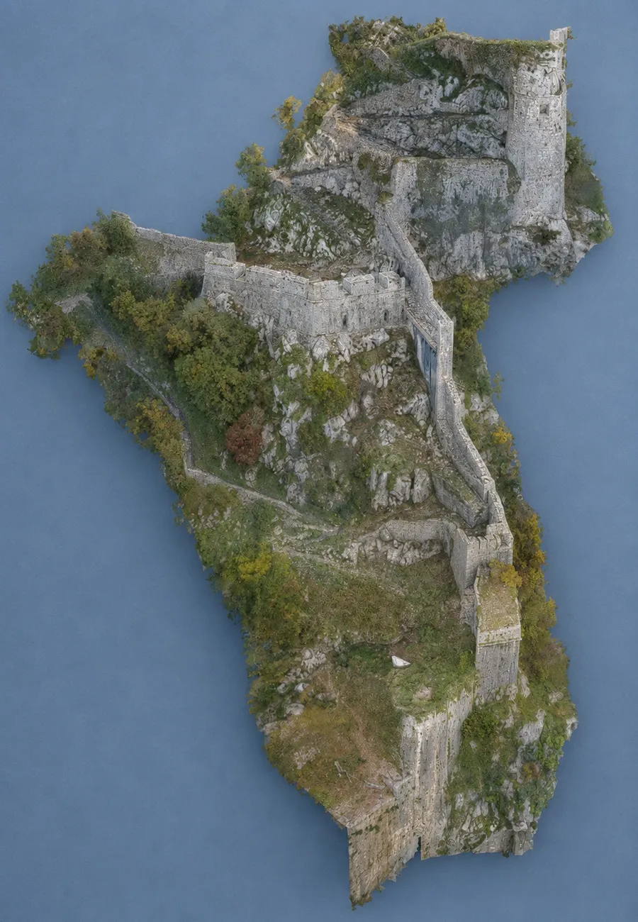
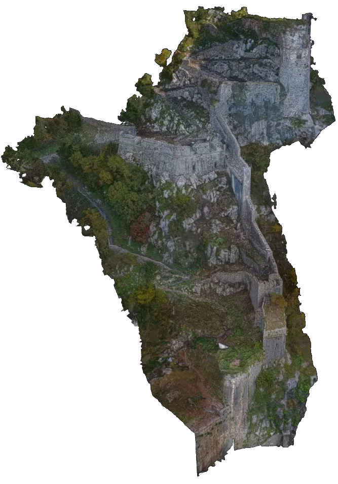
Today, the Saint Francis Position is being documented through modern surveying and digital modelling technologies. Detailed 3D visualisation allows visitors to understand the original appearance, military function and architectural significance of the fortification. This digital presentation helps preserve and interpret an important part of Kotor's cultural heritage for future generations.
Mid-16th Century
Construction of the Saint Francis Position
The Saint Francis Position is stylistically and chronologically dated to the mid-sixteenth century. It represents an authentic example of a modern artillery platform, or fortification point alla moderna, designed to control the southern sector of the Kotor Fortress near the Gurdić Gate. From this strategically important location, the defenders could respond to attacks approaching from both land and sea. Its architectural characteristics correspond to those of the Bembo and Riva bastions, placing it among the most important Venetian military works of the period.
1539
Barbarossa's Attack on Kotor
The Ottoman attack led by Hayreddin Barbarossa marked a turning point in the development of Kotor's fortifications. During this period Venice modernised the city's medieval walls by constructing new artillery bastions capable of resisting firearms. The Bembo and Riva bastions, built at the time of Barbarossa's campaign, share the same architectural characteristics as the Saint Francis Position and provide an important reference for dating its construction.
1584
First Historical Illustration
The earliest known depiction of the Saint Francis Position appears in Angelo degli Oddi's 1584 view of Kotor. Published in his work on the maritime provinces, the illustration records the southern fortifications together with stairways, communication routes and artillery positions on the hill of Saint John. Although simplified, it represents the first reliable historical image confirming the existence of the Saint Francis Position within the defensive system of Kotor.
1657
Demolition of the Saint Francis Monastery
During the Ottoman siege of Kotor in 1657, the Venetian authorities demolished the Saint Francis Monastery and Church outside the Gurdić Gate to prevent enemy forces from occupying the complex. Although the monastery disappeared, its name remained permanently associated with the nearby artillery position. Today, the Campo Santo archaeological site marks the location where the monastery once stood.
1667
Earthquake and Reconstruction
The devastating earthquake of 1667 caused extensive damage throughout Kotor, including sections of its defensive walls and military structures. Significant repairs and reconstruction followed in order to restore the fortress to full defensive capability. The disaster marked one of the most demanding periods in the history of maintaining the fortification system.
1747
The Saint Francis Powder Magazine
By the eighteenth century, the Saint Francis complex had developed into an integrated military zone connected by fortified communication routes. Historical documentation records the New Saint Francis Powder Magazine together with access routes protected by massive retaining walls, parapets and loopholes. These structures formed an essential part of the southern defensive sector and supplied the nearby artillery positions.
1768
Filseck's Plan
Moser de Filseck's military plan of 1768 provides the most detailed historical record of the Saint Francis Position. It identifies the Lower and Middle Saint Francis Lunettes, the guardhouse, the Upper Lunette, the Zen position and the powder magazine. The plan documents the organisation of the entire defensive complex and reflects the final major Venetian reconstruction of the Kotor Fortress.
1918
End of Military Function
The last military works on the fortress were carried out during the First World War. Following its end in 1918, the centuries-old border between the Bay of Kotor and Montenegro disappeared, and the fortress lost its strategic military importance. Without a permanent function, many of its structures gradually fell into decay.
1979
A New Phase of Preservation
The 1979 Montenegro earthquake caused severe damage to Kotor and its historic fortifications. In the years that followed, systematic documentation, conservation studies and restoration planning became an essential part of protecting the World Heritage Site. The Saint Francis Position was included within these long-term preservation efforts.
Today
3D Documentation and Digital Presentation
Today, the Saint Francis Position is being documented through modern surveying and digital modelling technologies. Detailed 3D visualisation allows visitors to understand the original appearance, military function and architectural significance of the fortification. This digital presentation helps preserve and interpret an important part of Kotor's cultural heritage for future generations.
Explore the Rampart
Interactive Map
Select a point to explore
Rampart in 3D
Explore the digital 3D model of the rampart directly on this page.
This project is funded through a U.S. Embassy grant. The opinions,
findings and conclusions expressed are those of the author(s) and do
not necessarily reflect those of the Department of State.